Fairemont
No Bullying Allowed
- Joined
- Apr 15, 2025
- Messages
- 604
- Points
- 108

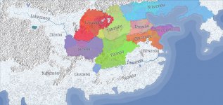
I created the heightmap from scratch, placed all the biomes, the mountain ranges, and many features (though a lot are generated based on those biomes). It has an insane degree of zoom which you can't see in the .jpeg.
I added all 15 provinces of the empire with authentic names, then I added and named all 97 (or so) commanderies with authentic, historical names! I named all like... 160 some rivers and the dozen or so major lakes.
I added and named cities, assigned populations, and even created routes.
I added markers for major locations (still working on this) like sects, mountains, and more!
Its been a ton of work. It might be worth it down the road when I start getting deeper into my story as it'll let me manage and track military deployments easier, as well as other types of geography-related developments.
But oh boy has it been a lot of work!
Do you like maps? If so, I would like to see your map.
Attachments
-
 Xi'an 2025-11-20-09-03.jpeg734.3 KB · Views: 33
 shaped.
  I love this kind of lore, and world building! it's so fun! I'm so excited for you!